| |
|
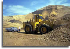
CONSTRUCTION AGGREGATE
|
 Geomapping
Associates Ltd. has served sand, gravel, and crushed rock producers,
constructions firms, and private landowners doing business in
the construction aggregate industry for over 30 years by supplying
geotechnical expertise for efficient planning, design, and monitoring
of pit and quarry operations. Construction aggregate producers
face rigorous challenges to maintain both raw material supply
and material quality to meet production goals. Geomapping
Associates Ltd. has served sand, gravel, and crushed rock producers,
constructions firms, and private landowners doing business in
the construction aggregate industry for over 30 years by supplying
geotechnical expertise for efficient planning, design, and monitoring
of pit and quarry operations. Construction aggregate producers
face rigorous challenges to maintain both raw material supply
and material quality to meet production goals.
-
Careful planning is required in order to achieve
a balance between meeting short term production demands and
maintaining economical extraction for the long term development
of the aggregate operation as a whole.
 Geomapping
professional consultants have the specific production experience
and knowledge of geologic conditions to assist your operation by
designing both short range and long range plans to: Geomapping
professional consultants have the specific production experience
and knowledge of geologic conditions to assist your operation by
designing both short range and long range plans to:
- Maximize Recoverable Sand,
Gravel or Stone Reserve Volume
- Maintain Quality Control
- Control Development Costs
- Address Land Use Issues
- Mitigate Environmental Concerns
- Implement Site Reclamation
|
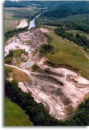
| Pit and quarry
operation plans must be based on a thorough understanding of the geology
of the project site. Once a sand and gravel or bedrock formation is
targeted for potential construction aggregate production, a comprehensive
geologic investigation of the deposit must be conducted in order to
delineate the deposit configuration in a three dimensional perspective,
to establish the recoverable reserve volume, and to determine material
quality and consistency. Geomapping professionals have the knowledge
and experience required to supply your pit or quarry development with
the essential geologic information necessary in order to make informed
planning decisions. Geomapping Associates Ltd. offers a systematic
approach in evaluating earth resources for construction aggregate
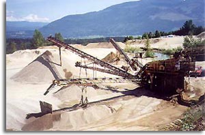
production. Services offered include: |
- Surface Geologic and Topographic Mapping
- Subsurface Geologic Investigations
- Digital Terrain Modeling and 3 Dimensional Section
Modeling
- Bulk Sampling and Trench Testing Programs
- Material Quality Sampling and Analysis
|
|
 The
Geomapping system for geologic prospecting and assessment involves
a phased approach to investigation designed to conserve your development
funds. Each phase of investigation providing the required baseline
field data and documentation for subsequent testing and design phases. The
Geomapping system for geologic prospecting and assessment involves
a phased approach to investigation designed to conserve your development
funds. Each phase of investigation providing the required baseline
field data and documentation for subsequent testing and design phases.
Building on baseline geologic information for
your project site, Geomapping professional consultants can guide
your construction aggregate operation through the planning, design,
and permitting phase of project development. We have planning, design,
and permitting experience for both the expansion of existing pit
and quarry operations, as well as, prospective greenfield projects.
Geomapping Associates Ltd. can assist your project with:
|
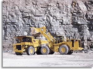
- Pit and Quarry Extraction Planning
- Calculation of Overburden Stripping Volume and
In-Place Raw Material Reserves
- Design of Pit and Quarry Bench Development and
Haulage Routes
- Design of Processing Facilities
- Reclamation Planning
- Overall Site Planning, Land Use Mapping, and Delineation
of Environmental Receptors
- Drainage and Erosion Control System Design
- Wastewater Disposal and Solid Waste Disposal System
Design
- Environmental Protection Planning and Design
- Environmental and Land Use Permit Impact Studies,
Expert Testimony and Application Preparation
|
 |
|
Financial audits for royalty agreements and valuation
appraisals for construction aggregate operations frequently demand
accurate and timely measurement of excavated space and product stockpiles.
Geomapping field professionals can support your auditing team by
supplying volumetric calculation of extracted reserves and product
stockpiles using the most up-to-date digital surveying and data
collection methods available. Geomapping utilizes this technology
in order to expedite the technical analysis phase of your project
and thereby supply your auditing team with the required data to
augment your schedule.
Email info@geomappingltd.com
for additional information on aggregate industry consulting services
provided by Geomapping Associates Ltd.. We are interested in discussing
your project today.
|
|
|